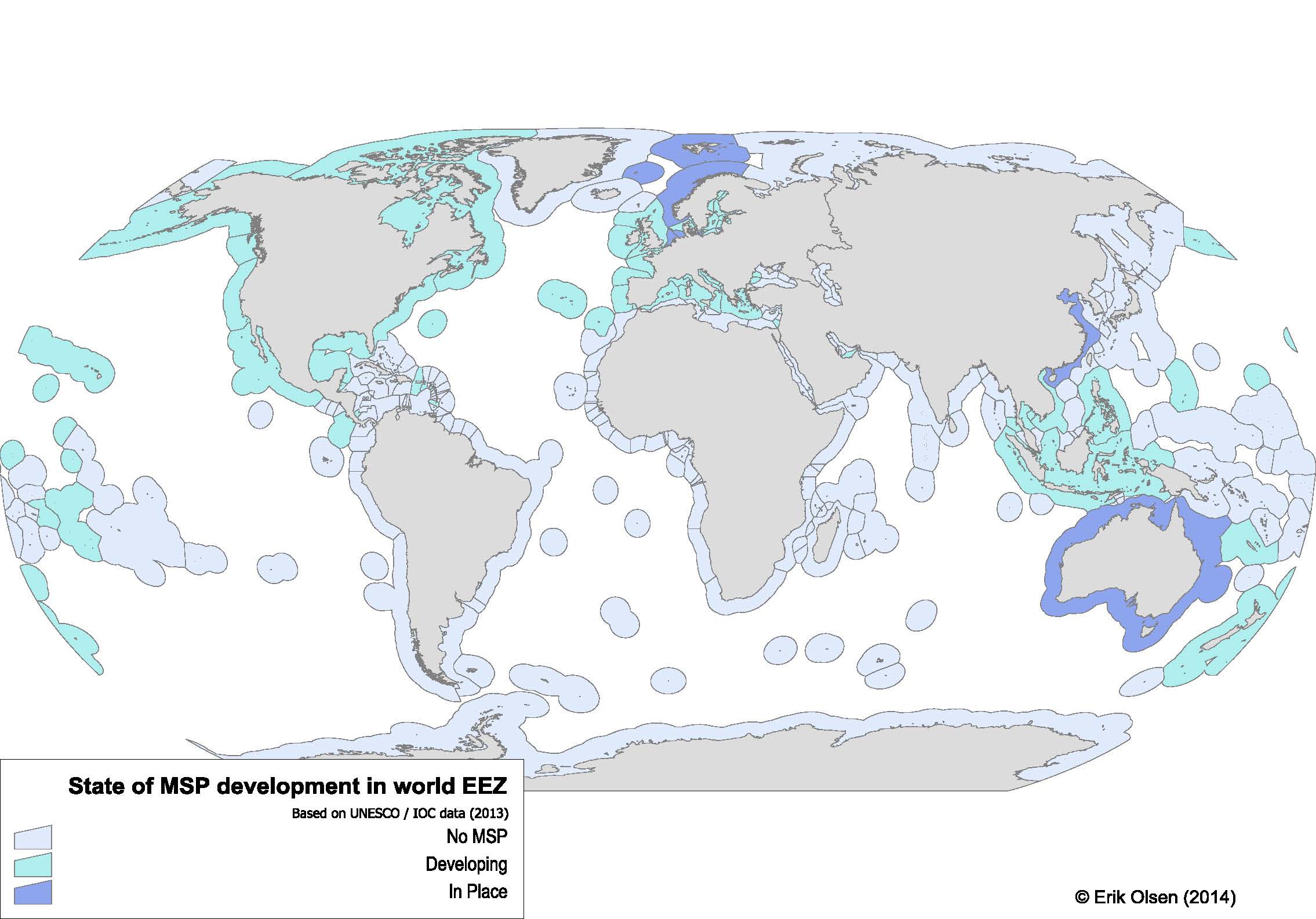
Preparing for a talk on MSP developments in Norway and globally I was looking for a global map of where marine spatial planning had been put in place and where it was being developed. Understanding and visualizing global developments of marine spatial planning (MSP) is of importance both to monitor and stud MSP, but also to understand the wider implementation of ecosystem-based management. Ironically no such map had been made (or Google was unable to find it for me). So I decided to make my own.
Methods
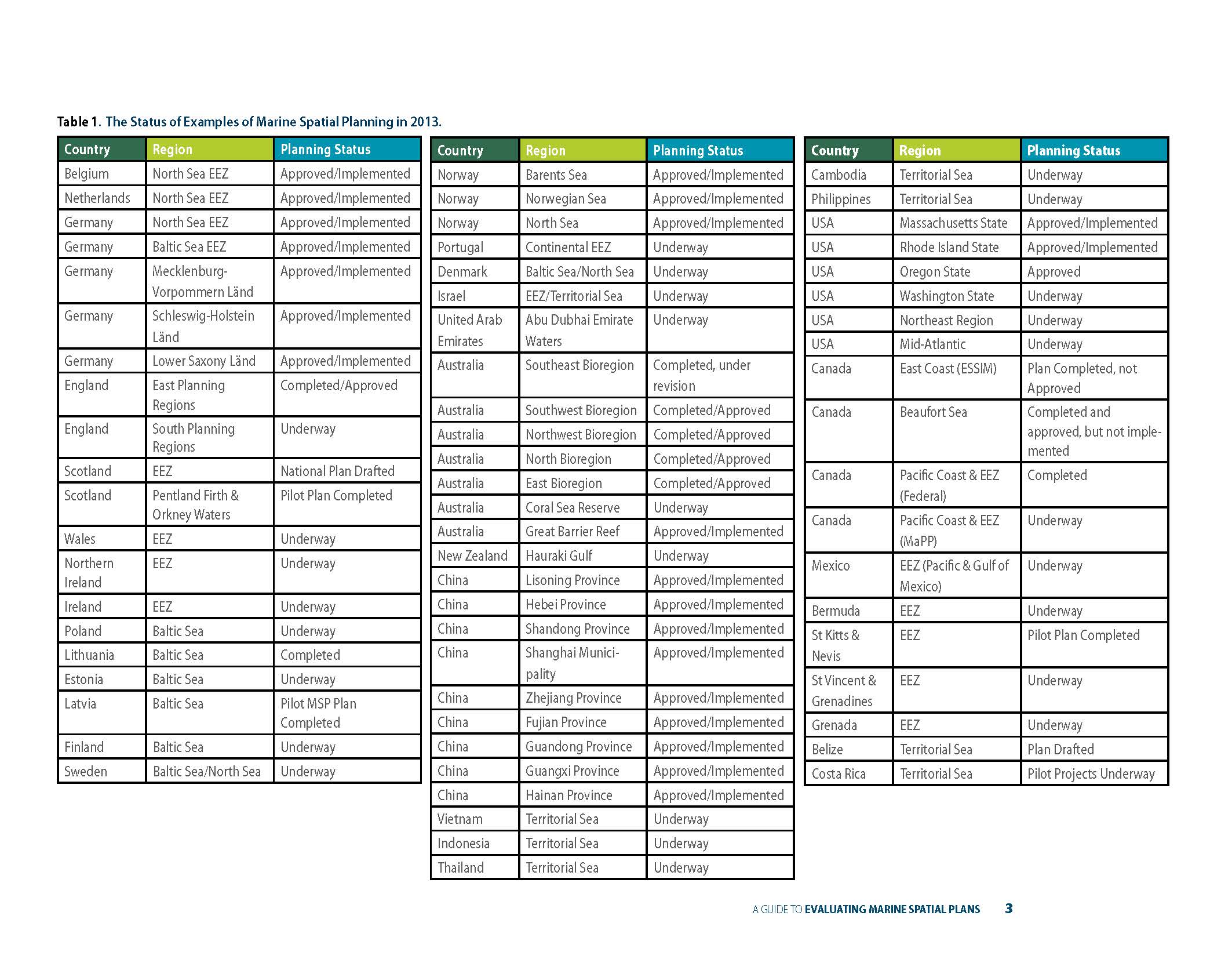
UNESCO – IOC keeps a web-page that lists MSP implementations worldwide which is presented in tabular form in table 2 (p. 16) in a recent report by Ehler (2014), and reprinted below in Figure 1.

Figure 1 Table of status of worldwide MSP implementation. Reprint of Table 2 in (Ehler 2014) (p. 16).
(Ehler 2014) uses a range of descriptions to define MSP status in the various countries and regions (Figure 1), but these are too many and incossistent to be used for mapping purposes.
In the map developed MSP status has been reclassified into two categories:
“In Place” which correspond to the following (Ehler 2014) categories: Approved/Implemented, Completed, Completed/Approved, Plan Completed, Completed under revision
“Developing” which corresponds to the following (Ehler 2014) categories: Underway, National Plan Drafted, Pilot plan completed, Pilot MSP plan completed, National plan drafted, Plan drafted, Pilot projects underway.
The status was mapped to a global map of national EEZs using Manifold v.8.0 GIS software. However, the EEZ map used did not have the sub-regional division for the UK, Australia, Canada and the US that (Ehler 2014) used.
Global Map
Below (Figure 2) is the MSP map developed. A high-definition .PDF file is available, and the map can be exported in other format and resolutions.

Figure 2 Global map of MSP developments. Data based on (Ehler 2014).
References
Ehler CN (2014) A guide to evaluating marine spatial plans. UNESCO, IOC Manuals and Guides, 70; ICAM Dossier 8, Paris, 98pp


